Built for iPad

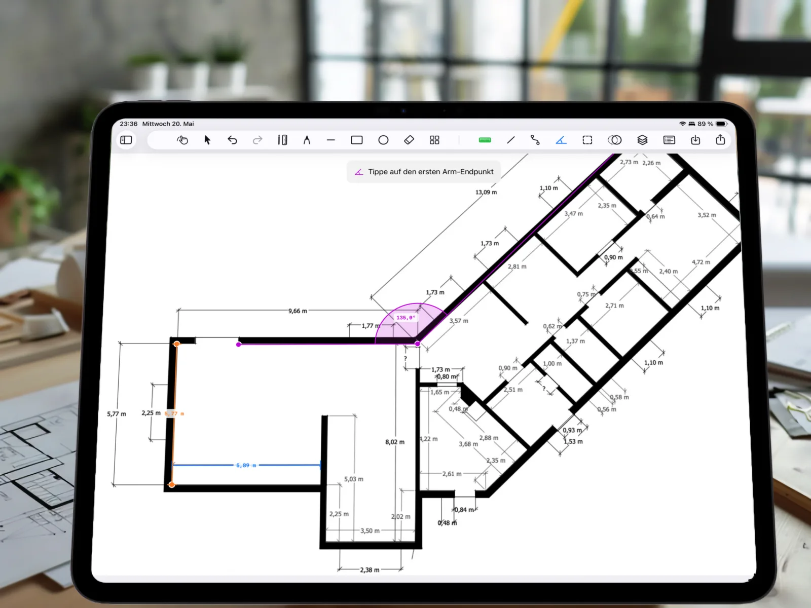
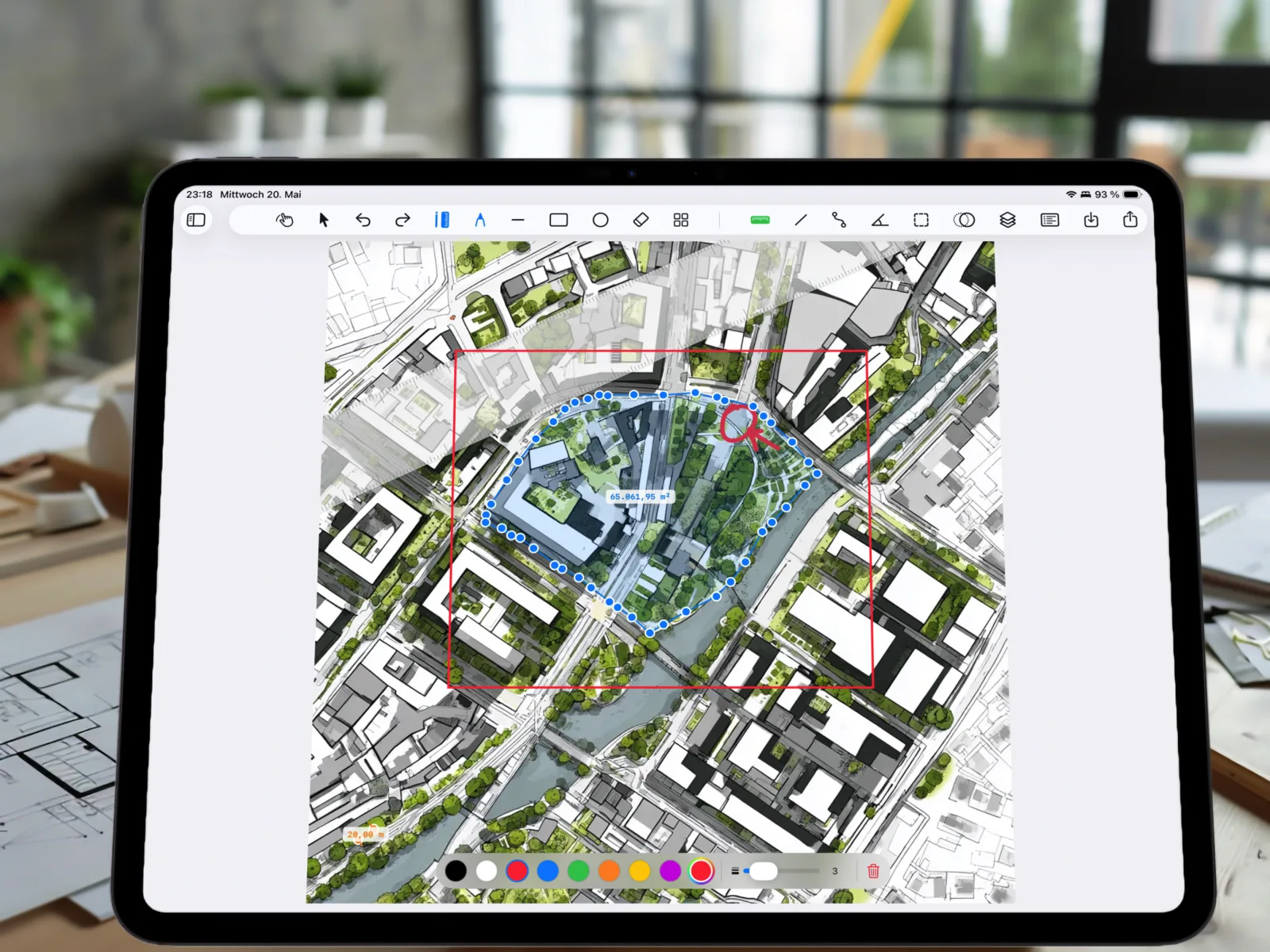
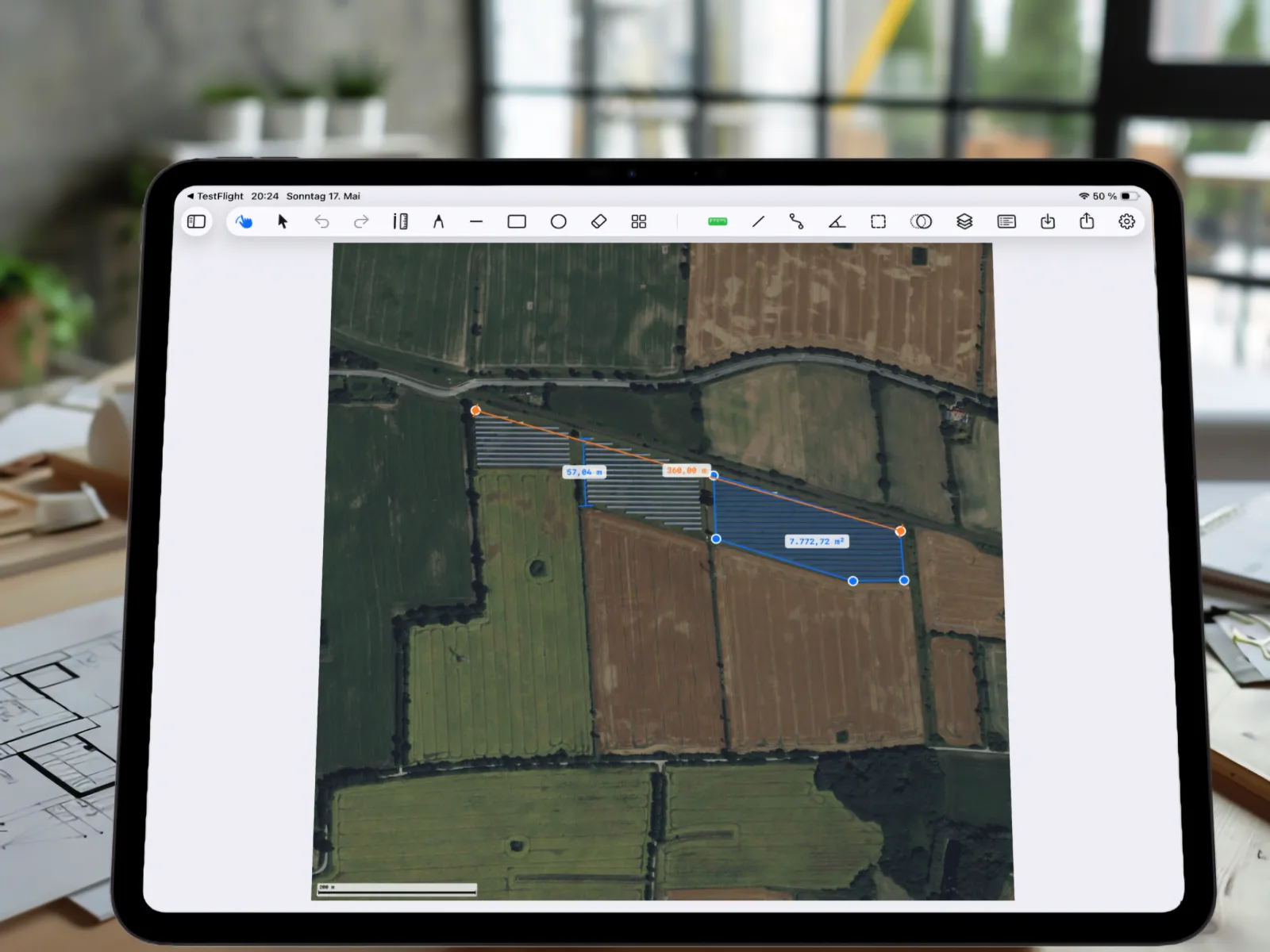
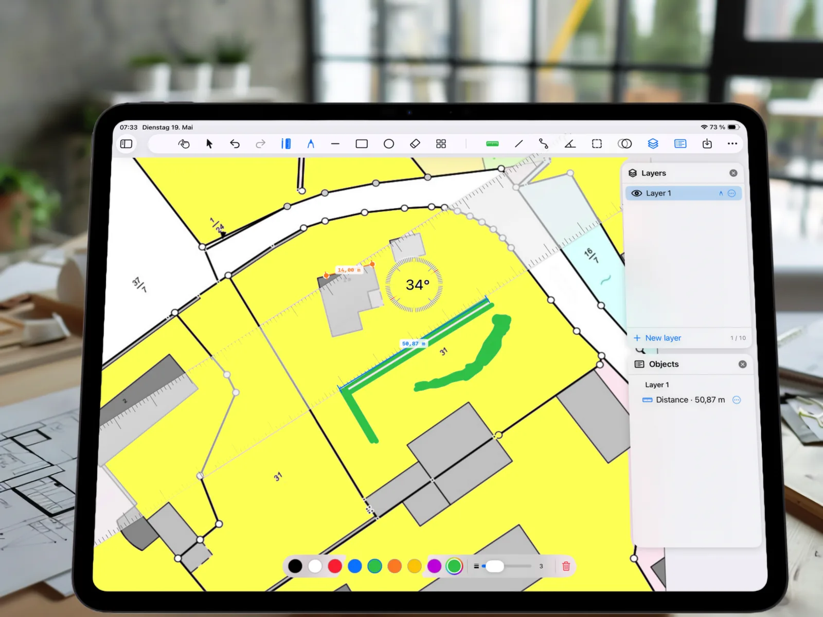
Measure plans, maps and floor plans — straight on your iPad.

Import a photo, a PDF or an Apple Maps snapshot, calibrate the scale and measure precisely – distances, areas, angles. Built for architects, landscape designers, farmers.

±0.1%
Measurement precision
10
Layers per project
PDF
Import & Export
PlanMeasure on iPad – floor plan measured directly on the desk

Every image becomes a measurable map

Four promises that turn PlanMeasure from a sketching app into an honest measurement tool.

01

What PlanMeasure does

PlanMeasure turns any image into a measurable map. Upload a photo of a floor plan, import a PDF site plan or grab a satellite snapshot from Apple Maps – calibrate the scale once, and every subsequent measurement is metrically correct.

02

Measures what needs measuring

The ruler captures distances, the path tool sums any number of points into a total length. The protractor measures slopes or corner angles to a tenth of a degree. Polygons turn into areas in m² – ideal for roofs, plots or rooms.

03

Annotate like on paper

Sketch freehand with Apple Pencil or your finger, drag lines, rectangles and rotatable markers. Place symbols for furniture, trees, vehicles or fixtures. Organise everything in up to 10 layers you can toggle any time.

04

Privacy built in

All plans and measurements stay on your iPad – no account, no tracking, no forced cloud. Optional iCloud sync if you use multiple devices.

Everything you need to measure

Eight tools in one app – calibrate, measure, sketch, document.

Calibrate scale

Drop two points, enter the real-world distance – PlanMeasure converts every length and area exactly from there.

Ruler & polylines

Point-to-point ruler or multi-segment polylines with running total – ideal for irregular paths.

Calculate area

Draw a polygon, get the area – exact computation via the shoelace formula with arbitrarily many vertices.

Protractor

Three points define an angle, including arc visualisation – plus a free-rotating protractor overlay.

PencilKit annotations

Draw directly on the plan with Apple Pencil – seven colours, variable stroke widths.

Symbol library

Around 90 symbols for furniture, trees, vehicles, fixtures – rotatable, scalable, groupable.

Layers & objects

Up to 10 layers per project – toggle measurements on/off, manage every object individually.

PDF & PNG export

All annotations on the plan – export as PDF or PNG with footer and scale bar.

From photo to measurement in seconds

Three sources, one workflow: import, calibrate, measure.

Apple Maps snapshot imported into PlanMeasure – park area calibrated and measured at 65,061.95 m²

Photo, PDF or satellite view

Pull in photos from your library, PDF plans from Files – such as cadastral maps or architectural drawings – or grab a fresh satellite snapshot from Apple Maps. With address and zip-code search.

  • Photos & screenshots
  • PDF & PNG/JPG from Files (e.g. cadastral maps)
  • Apple Maps satellite (100 m – 2 km)
Satellite image with calibrated polygon: 7,779 m² area, 97 m and 100 m side lengths

Two points. One distance. Done.

Place two reference points, enter the real distance – PlanMeasure converts every pixel of your plan into metres, centimetres, feet or inches. Even satellite imagery becomes a metrically correct map.

  • Scale stored per project
  • Switch between m / cm / ft / in
  • ±0.1 % accuracy with clean calibration
PlanMeasure on iPad: cadastral map with yellow-highlighted plot, 50.87 m distance measurement, 14.00 m segment, 34° angle, green pencil annotation and Layers/Objects panel

Measure, annotate, share

Use the ruler, angle and area tools. Annotate everything with PencilKit, organise measurements into layers – and export a PDF with scale bar to colleagues or clients.

  • Up to 10 layers per project
  • PDF/PNG export with footer & scale bar
  • Local storage – GDPR compliant

Who works faster with PlanMeasure

Four professions, one tool.

🏗️

Architects & site managers

Measure floor plans on site, annotate PDF plans with dimensions, capture as-built data digitally.

🌳

Landscape design

Read plot sizes from aerial views, plan paths and beds, derive material requirements straight from the app.

🌾

Farmers

Measure fields and plots from aerial views, plan access roads, read hedge and fence lengths directly from the map.

🏡

Owners & renovators

Get your renovation plan precise – measure rooms, carports, beds without hiring an architect.

Start free – unlock Pro when you need it

All measurement tools are included in the free tier. Pro unlocks unlimited projects, map import, all layers, the full symbol library and PDF/PNG export.

Free

For trying it out

€0forever
  • 3 projects
  • Photo & file import (PDF, image)
  • Map import (Apple Maps)
  • Calibrate scale
  • All measurement tools
  • 1 layer
  • 10 symbols
  • Pencil & annotations
  • PDF/PNG export
  • Undo / Redo

Subscription renews automatically. Cancel anytime in iPhone/iPad settings.

Ready to measure plans digitally?

PlanMeasure is available now on the App Store – download it and get started on your iPad.